
Brief history of the Barangay
Before Barangay DON BERNARDO A. NERI got its name now, it was then formerly known as SOUTHERN POBLACION, wherein the two (2) adjacent barangays ( D’BAN & SWP) were name after it, under the leadership of the elect Teniente del Barrio (w/c call now Punong Barangay) GABRIEL DOMINESE JR.
Barangay DON BERNARDO A.NERI, Calamba, Misamis Occidental was legislative council created under the LOCAL Government Code of 1991 , primarily because Tres de Mayo was created as a barangay out of traditional practices from among our forebears without legal foundation by the way of an ordinance unanimously approved by the Sangguniang barangay and duly ratified by the people.
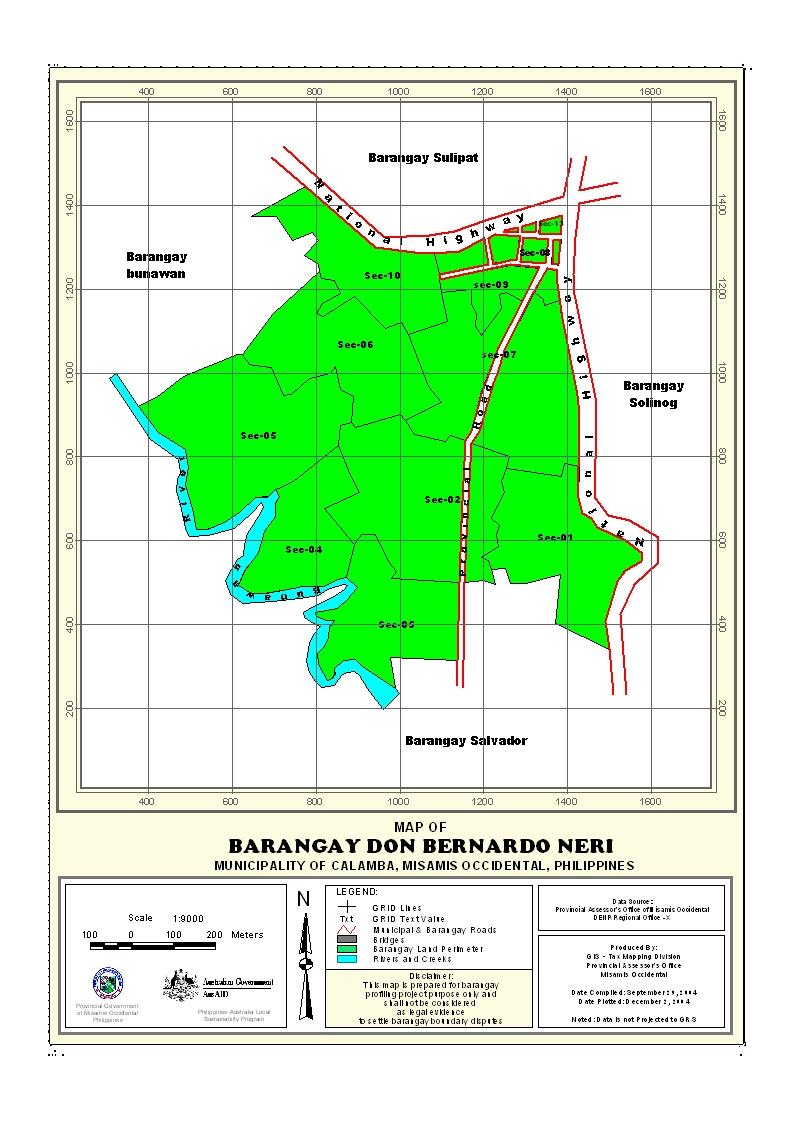
Geographical Location
Barangay D’ban is situated southern part of the municipality of Calamba, province of Misamis Occidental. It is the center of commerce and trade aside from farming wherein barangay D’ban is the center heart of the said municipality. It is bounded on the North by Southwestern , South by Dapacan Bajo, and East by Sulipat & West by Dapacan Bajo
Political Subdivision
There are 632 households residing in the barangay which comprises six (7) puroks. The puroks have an average distance of .50 km. from the barangay center, and also having an average of 75 households settling per purok. Purok 7 appears to be density populated while purok 1 has the lowest number of residential households. The barangay has a density of 342 households per sq. km. area.
Land Area
D’ban has a total land area of 2.50773 square kilometer or 178.9271 hectares. It is approximately 1.4 has had been used for public land of the total land area of the municipality. 50 of the total land area is coco land and 100 has. was used as home lot.
Topography and Land Classification
D’ban is low elevation and almost its area are flat lowlands. Estimated elevation of which in between the range from 75-250 meter above sea level and has a dominant slope of about 4-10%. Most of the area is cocoland , Only 2.5 has. is institutional land area.
Soil Types
The Barangay has soil type of clay loam. Interior portion of the barangay with bantog clay soil is devoted to lowland coconut while those with and clay loam are grown with fruit trees such as Lanzones.
Climate and Rainfall
The Barangay together with the Municipality is the same climatic classification, wherein there is no distinct wet and dry season. The rainiest month is December while the direst month is March. is evenly distributed throughout the year.
General Land Uses
General Land Uses | Area In Hectares | Percentage |
| Agricultural Lands | 157.0575 | 88% |
| Residential Land | 13.2708 | 7% |
| Commercial Land | 3.2913 | 5% |
Total | 178.9271 | 100% |
- Details
- Hits: 32636


