


Brief history of the Barangay
Before its creation, Barangay Dapacan Alto was known as Masidlakon and was part of the Municipality of Plaridel during the time of first Teniente del Barrio Eleno Raval. In the year 1935, Masidlakon was divided into two barangays namely; Dapacan Alto and Dapacan Bajo through the effort of the existing 80 families in the barangay. Primary School was built in time of the second teniente del barrio Cristobal Villarimo.
In the year 1948, Municipality of Calamba was created. Infrastructure like hanging bridge, roads and pathways were constructed during the time of Teniente del Barrio Jose Lantiese, the third teniente del barrio.
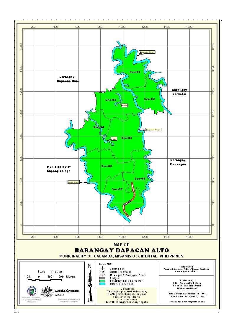
Geographical Location
Barangay Dapacan Alto is an upland area. Its distance from the town proper and national highway is 7.5 kilometers respectively and it takes ten (10) minutes to travel through motorcycle or “habal-habal”. It is accessible to all types of vehicles. Dapacan Alto is bounded on the North by Barangay Don Bernardo Andres Neri, South by Barangay Mauswagon, East by Barangay Salvador and West by Barangay Dapacan Bajo.
Political Subdivision
Barangay Dapacan Alto has 7 puroks: Purok 1, Purok 2, Purok 3, Purok 4, Purok 5.1, Purok 5.2 and Purok 6. It became a Barangay in the year 1935 under the leadership of the first Tenyente del Baryo Eleno Raval.
Land Area
Barangay Dapacan Alto has a total land area of 832 hectares. It has its land classification and uses. Source: CLUP
Topography and Land Classification
Its terrain is gently sloping to undulating with a slope of 3% and an elevation of 100-300 masl. The type of soil is Guimbaloan Clay Loam.
About 62% percent of the areas are agricultural land and some portions of it are public and residential land. The main crop planted is coconuts where mostly of the residents are farmer.
Soil Types
The soil type of all part of the barangay is classified as Guimbaloan Clay Loam. Source: CLUP
Climate and Rainfall
The Barangay together with the Municipality is under the Type IV climatic classification with no pronounced dry or wet season. This climate is characterized as moist, with an average rainfall of 2,278.7mm throughout the year. The wettest period spreads over an eight-month period from May to December, however, the rainiest months are in the last quarter of the year from October to December when 40% of the rainfall is recorded. While sparse rain showers are experienced during the remaining months, the driest months are February, March and April.
General Land Uses
Barangay Dapacan Alto has vast agricultural land area of 819.68 hectares. The most dominant farm product is coconut which covers the entire Barangay and about 99% are planted with corn, root crops, vegetables and fruit trees.
The average agricultural land holding per household is 3.28 hectares. About 80% of the farmers are tenants and some are usufruct and mortgage.
General Land Uses | Area In Hectares | Percentage |
| Agricultural Land and Other Uses | 819.68 | 99% |
| Residential | 11.50 | 1% |
Total | 831.18 | 100% |
- Details
- Hits: 23643


