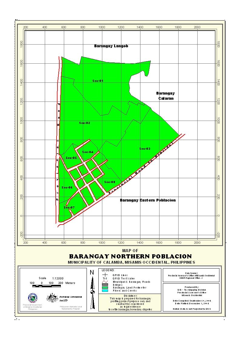
Geographical Location
Barangay Northern Poblacion is situated in the town proper of the municipality of Calamba, province of Misamis Occidental. It is bounded on the north by Barangay Langub, on the south by Barangay Solinog, on the east by Barangay Calaran, and on the west by Barangay Southwestern Poblacion.
Political Subdivision
There are 255 households in the barangay which comprises of three (3) puroks. Purok 1has 61 households with an average distance of 200 meters from the barangay office. Purok 2 has a total of 77 households with an average distance of 100 meters from the barangay office. Purok 3 has the highest number of household population with a total of 117 households. It is in purok 3 where the barangay office is located. The whole barangay has a density of 0.0001638 household per sq.m. area.
Land Area
Northern Poblacion has a total area of 1.5567 sq.km. or 155.67 hectares. It is approximately 0.14% of the total land area of the municipality. The said barangay has no area delineated under the Strategic Agricultural and Fishery Development Zone (SAFDZ).
Topography and Land Classification
Northern Poblacion is approximately 100 meters above sea level. It has a relative slope of 0-3%. Most of the areas are residential and commercial. Other areas are considered component areas to agricultural, non-agricultural, and industrial.
Soil Types
The barangay has soil type of guimbaloan clay and clay loam. The areas which are not highly populated are grown with coconut, root crops and fruit trees.
Climate and Rainfall
Barangay Northern Poblacion belongs to the fourth type of climate with no pronounced dry or wet seasons. The wettest period spreads over an eight-month period from May to December, however, the rainiest months are in the last quarter of the year from October to December when about 40% of the rainfall is recorded. The driest months are February, March and April.
General Land Uses
About 57.0809 hectares or 36.7% of the total barangay land area is used for agriculture. The residential area is 12.9057 hectares or 8.3% of the total barangay land area. The commercial land area is 2.5 hectares or 1.6% of the total barangay land area. The institutional area is 5.56 hectares or 3.6%, industrial area is 2 hectares or 1.3%, cemetery area is 2.91 hectares or 1.8%, open spaces area is 3 hectares or 1.9%, and other uses area is 69.7134 hectares or 44.8%. The total area used for agriculture is not included in the delineation of Strategic Agricultural and Fishery Development Zone (SAFDZ), which means that the total agricultural area can be reclassified into residential, commercial, industrial and other purposes.
- Details
- Hits: 19175